怎么使用Qt+GDAL库实现制作经纬度坐标转换工具
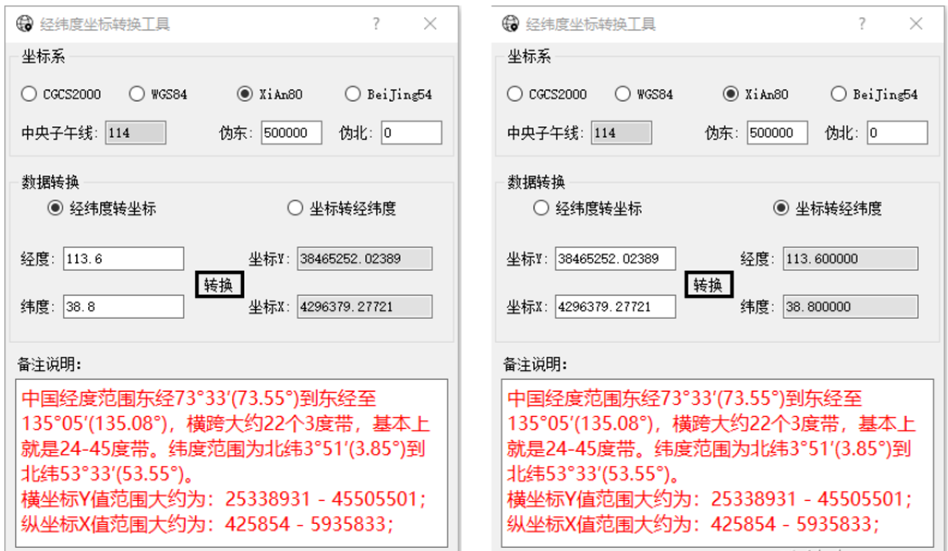
1、功能界面
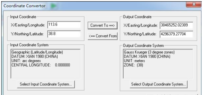
下面是用Global Mapper计算的结果,证明计算正确。
2、功能介绍
支持CGCS2000/WGS84/XIAN80/BEIJING54四种常用坐标系;
自动判断输入经纬度和X/Y坐标的合法性;
依据标准3°带自动计算中央子午线;
支持经纬度转投影坐标以及投影坐标转经纬度。
3、实现逻辑
1)利用GDAL库构建基础坐标系数据。
OGRSpatialReference m_spatialReference;

if(m_Coordinate == CoordinateDialog::CGCS2000)
    {
        qDebug() << "CGCS2000";
        m_spatialReference.importFromEPSG(4490);
    }
    else if(m_Coordinate == CoordinateDialog::WGS84)
    {
        qDebug() << "WGS84";
        m_spatialReference.importFromEPSG(4326);
    }
    else if(m_Coordinate == CoordinateDialog::XIAN80)
    {
        qDebug() << "XIAN80";
        m_spatialReference.importFromEPSG(4610);
    }
    else if(m_Coordinate == CoordinateDialog::BeiJing54)
    {
        qDebug() << "BeiJing54";
        m_spatialReference.importFromEPSG(4214);
    }
2)设定投影坐标系并进行转换
    m_spatialReference.SetTM(0.0, nMeridian, 1.0, nAreacode*1000000 + nOffsetE, nOffsetN);
	OGRSpatialReference* pLonLat = m_spatialReference.CloneGeogCS();

	// X、Y转经纬度
	OGRCoordinateTransformation* pXY2LonLat = OGRCreateCoordinateTransformation(&m_spatialReference, pLonLat);
	// 经纬度转X、Y
	OGRCoordinateTransformation* pXY2LonLat = OGRCreateCoordinateTransformation(&m_spatialReference, pLonLat);

    pXY2LonLat->Transform(1, &dLon, &dLat)